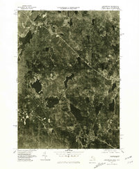
1975 Map of Ashburnham
USGS Topo · Published 1981About this map
Ashburnham and its outlying clusters are presented in this orthophotograph produced by the U. S. Geological Survey, capturing the dense woodlands and water bodies of Northern Worcester County in the mid-1970s. The imagery reveals the varied landscape of the Wapack Range as it extends toward the New Hampshire border, providing a clear view of the rural settlement patterns in villages like Lane Village and Wellville.
Find a feature on this map
9 named features on this map. Tap any name to fly to it.
Don’t see what you’re looking for? This feature index may not catch every label — zoom into the map to look around manually.
Map Details
Editions of this 1975 Ashburnham Map
This is the sole edition of this map. No revisions or reprints were ever made.
Other maps of this area

1887 · Winchendon
USGS Topo · 1:62,500

1887 · Fitchburg
USGS Topo · 1:62,500

1889 · Fitchburg
USGS Topo · 1:62,500

1890 · Winchendon
USGS Topo · 1:62,500

1893 · Fitchburg
USGS Topo · 1:62,500

1894 · Winchendon
USGS Topo · 1:62,500

1898 · Monadnock
USGS Topo · 1:62,500

1900 · Peterboro
USGS Topo · 1:62,500

1931 · Fitchburg
USGS Topo · 1:48,000

1932 · Winchendon
USGS Topo · 1:48,000