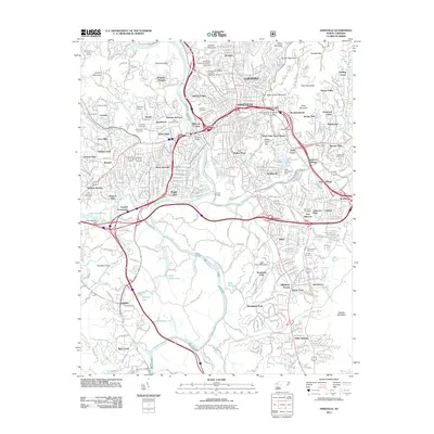
2011 Map of Asheville
USGS Topo · Published 2011About this map
The French Broad River and Swannanoa River converge at the heart of this urban and mountain landscape, defining the development of Asheville. This modern survey reveals the intricate road and rail network of the early 21st century, including the Southern rail lines and the prominent Beaucatcher Tunnel. For those researching family history, numerous burial grounds are detailed across the map, from the historic Riverside Cemetery near Montford Hills to the West Chapel Cemetery in the southern reaches of Shiloh. The map clearly illustrates the transition from the city's built-up core, including the University of North Carolina - Asheville, to the protected corridor of the Blue Ridge Pkwy and the wooded slopes of Beaucatcher Mountain and Patton Mountain. Residential expansion is visible in neighborhoods like Biltmore Forest, Kenilworth, and Sayles Village, while large recreational areas such as the Municipal Golf Course and Lake Ashnoca highlight the region's long-standing character.
Find a feature on this map
114 named features on this map. Tap any name to fly to it.
Don’t see what you’re looking for? This feature index may not catch every label — zoom into the map to look around manually.
Map Details
Editions of this 2011 Asheville Map
This is the sole edition of this map. No revisions or reprints were ever made.
Other maps of this area

1894 · Asheville
USGS Topo · 1:125,000

1900 · Mount Mitchell
USGS Topo · 1:125,000

1901 · Asheville
USGS Topo · 1:125,000

1902 · Mount Mitchell
USGS Topo · 1:125,000

1905 · Pisgah
USGS Topo · 1:125,000

1906 · Pisgah
USGS Topo · 1:125,000

1907 · Saluda
USGS Topo · 1:125,000

1935 · Craggy Pinnacle
USGS Topo · 1:24,000

1936 · Enka
USGS Topo · 1:24,000

1936 · Weaverville
USGS Topo · 1:24,000