
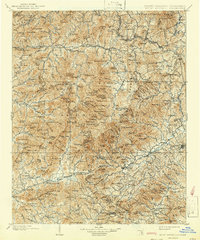
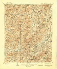
1902 Map of Mount Mitchell
USGS Topo · Published 1937About this map
Mt. Mitchell stands as the centerpiece of this terrain, anchoring the Black Mountains at a time when the region's high-altitude geography was first being systematically documented. This survey shows the area's transition from the 19th-century wilderness into a landscape of burgeoning rail-connected settlements. The Southern Railway winds through the southern gaps, connecting rail hubs like Old Fort and Marion, while the Catawba River and Swannanoa River dictate the settlement patterns in the lower elevations. Numerous smaller communities such as Graphiteville, Micaville, and Spruce Pine highlight the local mineral-driven economy of the era. The presence of the Pisgah National Forest and the Blue Ridge divide illustrates the early preservation and topographic boundary lines that would shape Western North Carolina for the next century.
Find a feature on this map
169 named features on this map. Tap any name to fly to it.
Don’t see what you’re looking for? This feature index may not catch every label — zoom into the map to look around manually.
Map Details
Editions of this 1902 Mount Mitchell Map
3 editions found
Other maps of this area

1891 · Roan Mountain
USGS Topo · 1:125,000

1892 · Greeneville
USGS Topo · 1:125,000

1893 · Cranberry
USGS Topo · 1:125,000

1894 · Asheville
USGS Topo · 1:125,000

1894 · Roan Mountain
USGS Topo · 1:125,000

1895 · Cranberry
USGS Topo · 1:125,000

1896 · Greeneville
USGS Topo · 1:125,000

1899 · Cranberry
USGS Topo · 1:125,000

1900 · Mount Mitchell
USGS Topo · 1:125,000

1901 · Asheville
USGS Topo · 1:125,000