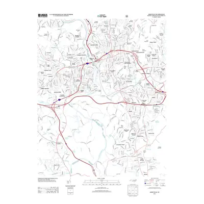
2013 Map of Asheville
USGS Topo · Published 2013About this map
The French Broad River and Swannanoa River converge in this 2013 survey of the mountain city, revealing a landscape defined by sharp elevation changes and distinct neighborhood identities. From the established estates of Biltmore Forest and the historic atmosphere of Montford Hills to the industrial history of Murphy Junction, the map illustrates a complex urban fabric woven around the Southern Ry lines. High points like Beaucatcher Mountain and Patton Mountain overlook the valley, while man-made water features such as Lake Kenilworth and Lake Ashnoca provide recreational focal points. The presence of the Blue Ridge Pkwy along the southern edge and the Carrier Bridge crossing the French Broad highlight the critical transportation infrastructure that has shaped the growth of communities like West Asheville and the Venable Community over decades of development.
Find a feature on this map
83 named features on this map. Tap any name to fly to it.
Don’t see what you’re looking for? This feature index may not catch every label — zoom into the map to look around manually.
Map Details
Editions of this 2013 Asheville Map
This is the sole edition of this map. No revisions or reprints were ever made.
Other maps of this area

1894 · Asheville
USGS Topo · 1:125,000

1900 · Mount Mitchell
USGS Topo · 1:125,000

1901 · Asheville
USGS Topo · 1:125,000

1902 · Mount Mitchell
USGS Topo · 1:125,000

1905 · Pisgah
USGS Topo · 1:125,000

1906 · Pisgah
USGS Topo · 1:125,000

1907 · Saluda
USGS Topo · 1:125,000

1935 · Craggy Pinnacle
USGS Topo · 1:24,000

1936 · Enka
USGS Topo · 1:24,000

1936 · Weaverville
USGS Topo · 1:24,000