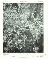
1976 Map of Asheville
USGS Topo · Published 1979About this map
Asheville is captured in this 1976 orthophoto at a moment of significant mid-century expansion, centered at the confluence of the French Broad River and the Swannanoa River. The aerial imagery reveals the dense residential and commercial layouts of West Asheville and the industrial-commercial hubs near Biltmore and Oakley. This perspective highlights the geographical constraints of the Blue Ridge foothills, where the steep terrain of Beaucatcher Mountain forced infrastructure into the river valleys. Unlike a traditional topographic map, the photographic detail on this sheet allows for the direct observation of land use patterns, from the winding residential streets and large commercial parking lots to the agricultural patches along Hominy Creek. The interplay between the natural waterways and the burgeoning highway network demonstrates the area's development as a regional transportation nexus in the late 1970s.
Find a feature on this map
8 named features on this map. Tap any name to fly to it.
Don’t see what you’re looking for? This feature index may not catch every label — zoom into the map to look around manually.
Map Details
Editions of this 1976 Asheville Map
This is the sole edition of this map. No revisions or reprints were ever made.
Other maps of this area

1894 · Asheville
USGS Topo · 1:125,000

1900 · Mount Mitchell
USGS Topo · 1:125,000

1901 · Asheville
USGS Topo · 1:125,000

1902 · Mount Mitchell
USGS Topo · 1:125,000

1905 · Pisgah
USGS Topo · 1:125,000

1906 · Pisgah
USGS Topo · 1:125,000

1907 · Saluda
USGS Topo · 1:125,000

1935 · Craggy Pinnacle
USGS Topo · 1:24,000

1936 · Enka
USGS Topo · 1:24,000

1936 · Weaverville
USGS Topo · 1:24,000