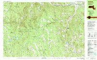
1990 Map of Ashfield
USGS Topo · Published 1990About this map
Ashfield and Plainfield serve as the primary hubs in this upland landscape of Franklin County, where the terrain is defined by numerous peaks such as Mt Owen and Peter Hill. The map reveals a deeply rooted rural infrastructure of small settlements like South Hawley, Watson, and Beldingville, connected by a network of winding roads. Many of these locations are adjacent to early burial grounds, including the Spruce Corner Cem and Pudding Hollow Cem, which provide significant points of interest for genealogists tracing family names in the area.
Find a feature on this map
104 named features on this map. Tap any name to fly to it.
Don’t see what you’re looking for? This feature index may not catch every label — zoom into the map to look around manually.
Map Details
Editions of this 1990 Ashfield Map
2 editions found
Other maps of this area

1885 · Northampton
USGS Topo · 1:62,500

1886 · Greylock
USGS Topo · 1:62,500

1886 · Hawley
USGS Topo · 1:62,500

1886 · Chesterfield
USGS Topo · 1:62,500

1886 · Northampton
USGS Topo · 1:62,500

1886 · Becket
USGS Topo · 1:62,500

1888 · Becket
USGS Topo · 1:62,500

1888 · Chesterfield
USGS Topo · 1:62,500

1890 · Hawley
USGS Topo · 1:62,500

1890 · Greenfield
USGS Topo · 1:62,500