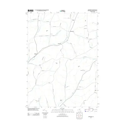
2013 Map of Ashford
USGS Topo · Published 2013About this map
Ashford and Devereaux anchor this rural Cattaraugus County landscape, where the terrain is defined by a series of prominent elevations including Canada Hill and Tug Hill. The settlement pattern follows the drainage of various waterways, such as Beaver Meadows Cr and Great Valley Cr, which cut through the high ground. Local history is etched into the names of smaller hamlets like Bakerstand and Fancy Tract, while genealogical interest is found at the Bryant Hill Cem and Root Cem. The road network connects these isolated pockets through passages like Morgan Hollow and across Bryant Hill, revealing a landscape that remained primarily agricultural and low-density into the early 21st century. The map illustrates how local topography influenced the placement of original farmsteads and transport routes through this portion of Western New York.
Find a feature on this map
73 named features on this map. Tap any name to fly to it.
Don’t see what you’re looking for? This feature index may not catch every label — zoom into the map to look around manually.
Map Details
Editions of this 2013 Ashford Map
This is the sole edition of this map. No revisions or reprints were ever made.
Other maps of this area

1898 · Olean
USGS Topo · 1:62,500

1900 · Salamanca
USGS Topo · 1:62,500

1924 · Ellicottville
USGS Topo · 1:62,500

1924 · Franklinville
USGS Topo · 1:62,500

1938 · Salamanca
USGS Topo · 1:62,500

1938 · Olean
USGS Topo · 1:62,500

1941 · Ellicottville
USGS Topo · 1:62,500

1942 · Franklinville
USGS Topo · 1:62,500

1943 · Olean
USGS Topo · 1:62,500

1943 · Salamanca
USGS Topo · 1:62,500