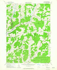
1964 Map of Ashford
USGS Topo · Published 1965About this map
Ashford and the surrounding Cattaraugus County countryside are defined by a complex network of upland hills and stream-cut valleys during the mid-1960s. The Baltimore and Ohio Railroad follows the path of Beaver Meadows Creek, connecting the settlement of Ashford with nearby Devereaux and Bakerstand. This transport corridor reflects the era's reliance on rail for moving resources through the western New York landscape.
Find a feature on this map
51 named features on this map. Tap any name to fly to it.
Don’t see what you’re looking for? This feature index may not catch every label — zoom into the map to look around manually.
Map Details
Editions of this 1964 Ashford Map
This is the sole edition of this map. No revisions or reprints were ever made.
Other maps of this area

1898 · Olean
USGS Topo · 1:62,500

1900 · Salamanca
USGS Topo · 1:62,500

1924 · Ellicottville
USGS Topo · 1:62,500

1924 · Franklinville
USGS Topo · 1:62,500

1938 · Salamanca
USGS Topo · 1:62,500

1938 · Olean
USGS Topo · 1:62,500

1941 · Ellicottville
USGS Topo · 1:62,500

1942 · Franklinville
USGS Topo · 1:62,500

1943 · Olean
USGS Topo · 1:62,500

1943 · Salamanca
USGS Topo · 1:62,500