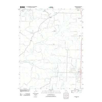
2011 Map of Ashland
USGS Topo · Published 2011About this map
Ashland anchor the southern reach of this Boone County landscape, showing its modern footprint alongside the historical rural network of central Missouri. The terrain is defined by a dense system of waterways, most notably the Little Bonne Femme Creek and its many tributaries like Gans Creek and Turkey Creek, which carve through the limestone-rich topography. Notable geological and recreational landmarks include the Rock Bridge area and the distinctively named Devils Icebox.
Find a feature on this map
95 named features on this map. Tap any name to fly to it.
Don’t see what you’re looking for? This feature index may not catch every label — zoom into the map to look around manually.
Map Details
Editions of this 2011 Ashland Map
This is the sole edition of this map. No revisions or reprints were ever made.
Other maps of this area

1886 · Jefferson City
USGS Topo · 1:125,000

1894 · Jefferson City
USGS Topo · 1:125,000

1935 · Columbia
USGS Topo · 1:24,000

1939 · Jefferson City
USGS Topo · 1:62,500

1940 · Columbia
USGS Topo · 1:24,000

1942 · Jefferson City
USGS Topo · 1:62,500

1944 · Millersburg
USGS Topo · 1:62,500

1946 · Millersburg
USGS Topo · 1:62,500

1947 · Jefferson City
USGS Topo · 1:250,000

1948 · Centertown
USGS Topo · 1:62,500