2021 Map of Ashland
USGS Topo · Published 2021About this map
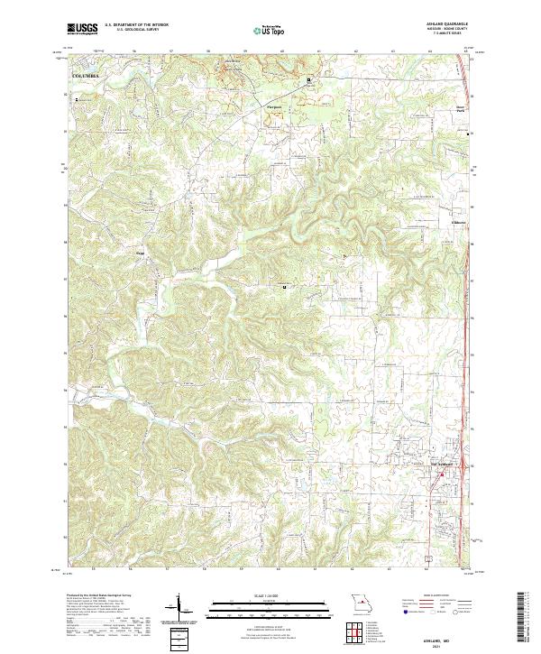
Ashland anchors the southeastern corner of this Boone County landscape, showing the town's street grid and development along the primary highway corridor. The terrain is defined by the winding course of Bonne Femme Creek and its many tributaries, such as Fox Hollow Br and Glastock Br. The area south of Columbia transitions from the city's outskirts into a land of ridges and valleys, featuring landmarks like Rock Bridge and the Devils Icebox. Local history and genealogy are preserved in several family and community burial grounds, including Samuel Cem and Oakland Cem. The map traces a network of rural roads like W Nashville Church Rd and S Tomlin Hill Rd, reflecting the long-established agricultural and residential patterns between the settlements of Sapp and Pierpont.
Find a feature on this map
118 named features on this map. Tap any name to fly to it.
Don’t see what you’re looking for? This feature index may not catch every label — zoom into the map to look around manually.
Map Details
Editions of this 2021 Ashland Map
This is the sole edition of this map. No revisions or reprints were ever made.