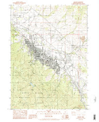
1983 Map of Ashland
USGS Topo · Published 1983About this map
The town of Ashland serves as a focal point for this 1983 survey, illustrating the complex intersection of academic, municipal, and industrial infrastructure at the edge of the Rogue River National Forest. The campus of Southern Oregon State College occupies a central position, reflecting the community's development as an educational hub. To the north and east, the transportation network is anchored by Interstate 5 and the Southern Pacific railroad, which run parallel through the valley.
Find a feature on this map
47 named features on this map. Tap any name to fly to it.
Don’t see what you’re looking for? This feature index may not catch every label — zoom into the map to look around manually.
Map Details
Editions of this 1983 Ashland Map
This is the sole edition of this map. No revisions or reprints were ever made.
Other maps of this area

1891 · Ashland
USGS Topo · 1:250,000

1893 · Ashland
USGS Topo · 1:250,000

1897 · Ashland
USGS Topo · 1:250,000

1938 · Medford
USGS Topo · 1:125,000

1954 · Medford
USGS Topo · 1:62,500

1954 · Lakecreek
USGS Topo · 1:62,500

1954 · Talent
USGS Topo · 1:62,500

1954 · Ashland
USGS Topo · 1:62,500

1955 · Medford
USGS Topo · 1:250,000

1957 · Medford
USGS Topo · 1:250,000