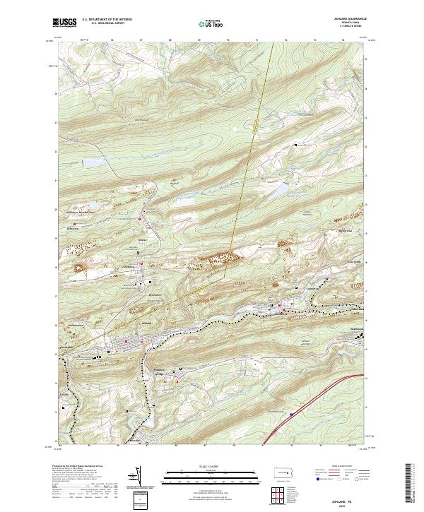
2023 Map of Ashland
USGS Topo · Published 2023About this map
Centralia and the surrounding anthracite coal region of Schuylkill County are documented in this 2023 survey, showing the complex topography of Locust Mountain and Ashland Mountain. The landscape is defined by the Ashland Anticline and a dense network of mining-era settlements, including Ashland, Girardville, and Gordon. This modern record is particularly valuable for genealogists, as it meticulously identifies numerous local burial grounds such as Odd Fellows Cem, Saints Peter and Paul Orthodox Cem, and the Saint Michaels Ukrainian Greek Catholic Cem.
Find a feature on this map
115 named features on this map. Tap any name to fly to it.
Don’t see what you’re looking for? This feature index may not catch every label — zoom into the map to look around manually.
Map Details
Editions of this 2023 Ashland Map
This is the sole edition of this map. No revisions or reprints were ever made.
Historical Maps of Englewood Through Time
4 maps found