
1947 Map of Ashland
USGS Topo · Published 1947About this map
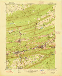
The rugged coal country of the Pennsylvania anthracite region is captured here, centered on the dense grids of Ashland, Centralia, and Girardville. These valley settlements are defined by their proximity to the Reading railroad lines and the steep ridges of Big Mountain and Ashland Mountain. The landscape reveals the intense industrial and institutional development of the mid-1940s, from the Miners Hospital in Fountain Springs to the Centralia Fire Tower overlooking the valley. The map documents the tight relationship between the geography of the Lehigh Valley and the placement of collieries and company towns. Water management for the local population and industry is evidenced by the Ashland Res, while social infrastructure is visible through landmarks like the Immaculate Heart Academy and Beaver Meadow Sch.
Find a feature on this map
44 named features on this map. Tap any name to fly to it.
Don’t see what you’re looking for? This feature index may not catch every label — zoom into the map to look around manually.
Map Details
Editions of this 1947 Ashland Map
3 editions found
Other maps of this area

1889 · Catawissa
USGS Topo · 1:62,500

1889 · Pottsville
USGS Topo · 1:62,500

1891 · Pottsville
USGS Topo · 1:62,500

1892 · Catawissa
USGS Topo · 1:62,500

1892 · Mahanoy
USGS Topo · 1:62,500

1892 · Pine Grove
USGS Topo · 1:62,500

1893 · Mahanoy
USGS Topo · 1:62,500

1894 · Catawissa
USGS Topo · 1:62,500

1944 · Pottsville
USGS Topo · 1:24,000
1947 · Mt. Carmel
USGS Topo · 1:24,000