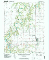
1998 Map of Ashmore
USGS Topo · Published 2003About this map
The Embarras River winds through the heart of this East-Central Illinois landscape, carving a heavily wooded riparian corridor that contrasts sharply with the surrounding agricultural grid of Morgan and East Oakland townships. Near a sharp bend in the river, the Airtight Bridge serves as a notable crossing point, while the smaller Little Embarras River and Brush Creek drain the upland fields to the east. The village of Ashmore anchors the southeastern corner of the sheet, situated along the Charleston rail line and just south of the Reed Landing Strip.
Find a feature on this map
31 named features on this map. Tap any name to fly to it.
Don’t see what you’re looking for? This feature index may not catch every label — zoom into the map to look around manually.
Map Details
Editions of this 1998 Ashmore Map
This is the sole edition of this map. No revisions or reprints were ever made.
Other maps of this area

1933 · Toledo
USGS Topo · 1:62,500

1936 · Oakland
USGS Topo · 1:48,000

1936 · Casey
USGS Topo · 1:48,000

1938 · Toledo
USGS Topo · 1:62,500

1942 · Oakland
USGS Topo · 1:62,500

1942 · Casey
USGS Topo · 1:62,500

1943 · Casey
USGS Topo · 1:62,500

1946 · Kansas
USGS Topo · 1:62,500

1949 · Kansas
USGS Topo · 1:62,500

1953 · Indianapolis
USGS Topo · 1:250,000