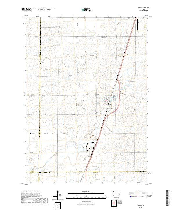
2022 Map of Ashton
USGS Topo · Published 2022About this map
Ashton serves as the central hub of this Northwest Iowa landscape, positioned within the distinctive Coteau des Prairies upland region. The town is flanked by historic burial grounds including Saint Marys Cem and Gilman Cem, while the Quaker Cem sits further west near the Lyon and Osceola county line. This map captures a region defined by its precise grid of section roads and the winding drainage paths of Otter Cr and Rat Cr. The intersection of state and county routes like Co Hwy A34 and Co Hwy A52 illustrates the importance of agricultural transport in Osceola County. In the northeast corner, the Sibley Municipal Airport marks a modern transition in a landscape historically shaped by small-scale farming and local stream networks like Kappes Cr and Wagner Cr.
Find a feature on this map
50 named features on this map. Tap any name to fly to it.
Don’t see what you’re looking for? This feature index may not catch every label — zoom into the map to look around manually.
Map Details
Editions of this 2022 Ashton Map
This is the sole edition of this map. No revisions or reprints were ever made.
Other maps of this area

1954 · Fairmont
USGS Topo · 1:250,000

1958 · Fairmont
USGS Topo · 1:250,000

1964 · Matlock
USGS Topo · 1:24,000

1964 · Sheldon
USGS Topo · 1:24,000

1964 · Sanborn
USGS Topo · 1:24,000

1972 · Ashton
USGS Topo · 1:24,000
1972 · Little Rock
USGS Topo · 1:24,000

1972 · Sibley West
USGS Topo · 1:24,000
1972 · George East
USGS Topo · 1:24,000

1972 · Cloverdale
USGS Topo · 1:24,000