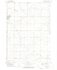
1972 Map of George East
USGS Topo · Published 1975About this map
George serves as the primary hub in this northwestern Iowa landscape, where agricultural land is neatly partitioned by the section lines of Liberal, Grant, Wheeler, and Dale townships. The town's connection to the wider region is anchored by the Illinois Central Gulf railroad, which cuts a diagonal path across the prairie. Local industry and aviation are represented by several sandpits and the Sudenga Industries Landing Field, reflecting the area's development in the early 1970s.
Find a feature on this map
18 named features on this map. Tap any name to fly to it.
Don’t see what you’re looking for? This feature index may not catch every label — zoom into the map to look around manually.
Map Details
Editions of this 1972 George East Map
This is the sole edition of this map. No revisions or reprints were ever made.
Other maps of this area

1954 · Fairmont
USGS Topo · 1:250,000

1955 · Sioux Falls
USGS Topo · 1:250,000

1958 · Sioux Falls
USGS Topo · 1:250,000

1958 · Fairmont
USGS Topo · 1:250,000

1964 · Matlock
USGS Topo · 1:24,000

1964 · Sheldon
USGS Topo · 1:24,000

1964 · Boyden
USGS Topo · 1:24,000

1971 · Edna
USGS Topo · 1:24,000

1971 · George West
USGS Topo · 1:24,000

1972 · Ashton
USGS Topo · 1:24,000