
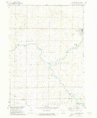
1971 Map of George West
USGS Topo · Published 1973About this map
The town of George occupies the northeastern corner of this Northwest Iowa landscape, where the Illinois Central railroad cuts across the prairie. The town's layout is centered near Evergreen Cem, with the meandering course of Rio Grande Creek passing just to the south. The agricultural character of the region is evident in the township structure, spanning portions of Rock, Liberal, Garfield, and Wheeler.
Find a feature on this map
19 named features on this map. Tap any name to fly to it.
Don’t see what you’re looking for? This feature index may not catch every label — zoom into the map to look around manually.
Map Details
Editions of this 1971 George West Map
2 editions found
Other maps of this area

1954 · Fairmont
USGS Topo · 1:250,000

1955 · Sioux Falls
USGS Topo · 1:250,000

1958 · Sioux Falls
USGS Topo · 1:250,000

1958 · Fairmont
USGS Topo · 1:250,000

1964 · Matlock
USGS Topo · 1:24,000

1964 · Boyden
USGS Topo · 1:24,000

1964 · Hull
USGS Topo · 1:24,000

1971 · Edna
USGS Topo · 1:24,000

1971 · Rock Rapids
USGS Topo · 1:24,000

1971 · Doon
USGS Topo · 1:24,000