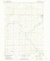
1971 Map of George West
USGS Topo · Published 1973About this map
The settlement of George sits at a vital crossing of the Illinois Central railroad and the upper reaches of the Little Rock River during the early 1970s. This agricultural landscape in Lyon County is defined by a grid of townships including Rock, Liberal, and Wheeler, where small country landmarks like Hope Ch and Evergreen Cem served the local farming community. The terrain is shaped by the winding paths of Otter Creek and the curiously named Rio Grande stream, which flows south toward the Lyon and Sioux County line. Evidence of local industry and infrastructure is present in the form of a Gravel Pit and a prominent Radio Tower, while the Boyden Recreation Area near the southern border provides a rare pocket of public leisure space amidst the productive fields.
Find a feature on this map
20 named features on this map. Tap any name to fly to it.
Don’t see what you’re looking for? This feature index may not catch every label — zoom into the map to look around manually.
Map Details
Editions of this 1971 George West Map
2 editions found
Other maps of this area

1954 · Fairmont
USGS Topo · 1:250,000

1955 · Sioux Falls
USGS Topo · 1:250,000

1958 · Sioux Falls
USGS Topo · 1:250,000

1958 · Fairmont
USGS Topo · 1:250,000

1964 · Matlock
USGS Topo · 1:24,000

1964 · Boyden
USGS Topo · 1:24,000

1964 · Hull
USGS Topo · 1:24,000

1971 · Edna
USGS Topo · 1:24,000

1971 · George West
USGS Topo · 1:24,000

1971 · Rock Rapids
USGS Topo · 1:24,000