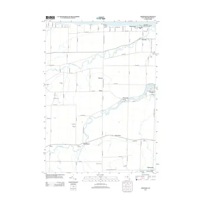
2013 Map of Ashwood
USGS Topo · Published 2013About this map
Lake Ontario shorelines and the meandering Oak Orchard River define this rural landscape north of Albion. The geography is marked by small settlements and family farms, including Kuckville, Kenyonville, and the waterside cluster at Lakeside Park. The prominence of local cemeteries like Greenman Cem, Fuller Cem, and Otter Creek Cem provides a clear record of established family lines throughout the township.
Find a feature on this map
92 named features on this map. Tap any name to fly to it.
Don’t see what you’re looking for? This feature index may not catch every label — zoom into the map to look around manually.
Map Details
Editions of this 2013 Ashwood Map
This is the sole edition of this map. No revisions or reprints were ever made.
Other maps of this area

1897 · Albion
USGS Topo · 1:62,500

1897 · Medina
USGS Topo · 1:62,500

1897 · Oak Orchard
USGS Topo · 1:62,500

1897 · Ridgeway
USGS Topo · 1:62,500

1944 · Ashwood
USGS Topo · 1:31,680

1944 · Albion
USGS Topo · 1:31,680

1949 · Kendall
USGS Topo · 1:62,500
1949 · Medina
USGS Topo · 1:24,000
1950 · Knowlesville
USGS Topo · 1:24,000
1950 · Medina
USGS Topo · 1:62,500