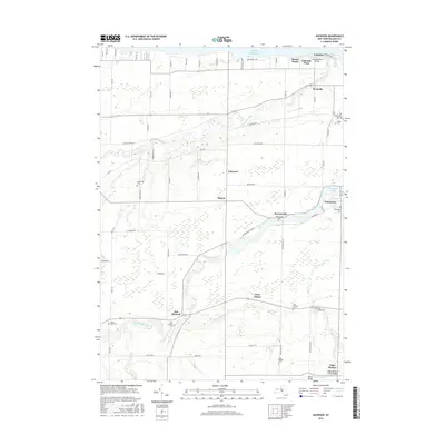
2016 Map of Ashwood
USGS Topo · Published 2016About this map
Lake Ontario defines the northern edge of this Orleans County landscape, where the shoreline is dotted with summer-season settlements like Lakeside Park and Sunset Beach. Moving inland, the terrain is shaped by the winding courses of Johnson Creek and the Oak Orchard River, which feeds into the prominent Waterport Pond. This map is a significant resource for genealogists, as it identifies numerous family-named burial sites across the township, including the Carlton Cem, Fuller Cem, and Greenman Cem. In the southern portion of the quadrangle, the historic Erie Canal cuts through the area near Eagle Harbor, anchoring the regional transport network. Small hamlets like Kenyonville, Ashwood, and Platten are connected by a grid of rural roads, illustrating the enduring agricultural and residential patterns of Western New York in the early 21st century.
Find a feature on this map
74 named features on this map. Tap any name to fly to it.
Don’t see what you’re looking for? This feature index may not catch every label — zoom into the map to look around manually.
Map Details
Editions of this 2016 Ashwood Map
This is the sole edition of this map. No revisions or reprints were ever made.
Other maps of this area

1897 · Albion
USGS Topo · 1:62,500

1897 · Medina
USGS Topo · 1:62,500

1897 · Oak Orchard
USGS Topo · 1:62,500

1897 · Ridgeway
USGS Topo · 1:62,500

1944 · Ashwood
USGS Topo · 1:31,680

1944 · Albion
USGS Topo · 1:31,680

1949 · Kendall
USGS Topo · 1:62,500
1949 · Medina
USGS Topo · 1:24,000
1950 · Knowlesville
USGS Topo · 1:24,000
1950 · Medina
USGS Topo · 1:62,500