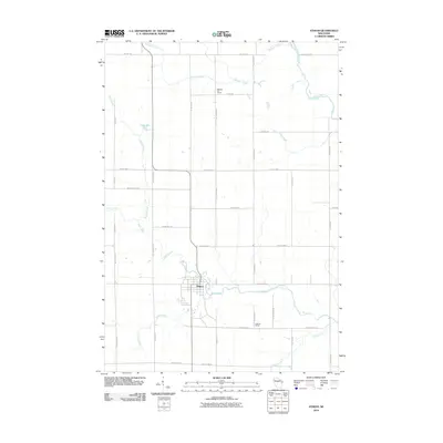
2010 Map of Athens
USGS Topo · Published 2010About this map
Athens serves as the central hub of this Marathon County landscape, where the confluence of several waterways defines the rural layout. The town is situated along Black Creek, which winds eastward toward the Big Rib River in the northeast. This 2010 survey illustrates a grid of section-line roads, many bearing family and local names such as Nehrbass Rd, Wozniak Rd, and Doering Rd, indicating the deep-rooted agricultural settlement of the region. Educational history is preserved through the locations of the Baldwin Hill School in the north and the Hoffman School to the south. Small water bodies like Lake Allu and a network of drainages including Potato Creek, Stony Creek, and Baldwin Creek crisscross the farmland, showing the natural drainage patterns that have shaped land use and property boundaries for generations of Wisconsin residents.
Find a feature on this map
38 named features on this map. Tap any name to fly to it.
Don’t see what you’re looking for? This feature index may not catch every label — zoom into the map to look around manually.
Map Details
Editions of this 2010 Athens Map
This is the sole edition of this map. No revisions or reprints were ever made.
Other maps of this area

1902 · Marathon
USGS Topo · 1:125,000

1951 · Athens
USGS Topo · 1:48,000

1951 · Hamburg
USGS Topo · 1:48,000

1953 · Marathon
USGS Topo · 1:48,000

1953 · Stratford
USGS Topo · 1:48,000

1953 · Eau Claire
USGS Topo · 1:250,000

1953 · Rice Lake
USGS Topo · 1:250,000

1954 · Iron Mountain
USGS Topo · 1:250,000

1955 · Green Bay
USGS Topo · 1:250,000

1958 · Eau Claire
USGS Topo · 1:250,000