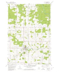
1980 Map of Athens
USGS Topo · Published 1980About this map
The village of Athens serves as the primary hub in this central Wisconsin landscape, situated where the terrain transitions between the townships of Bern, Halsey, Johnson, and Rietbrock. The village is centered on a grid near Black Creek, supported by civic infrastructure including a Cem, High Sch, and the riverside Athens County Park. A prominent Old Railroad Grade snakes through the northern hills toward Baldwin, marking the path of former timber or freight transport that once linked these isolated settlements.
Find a feature on this map
26 named features on this map. Tap any name to fly to it.
Don’t see what you’re looking for? This feature index may not catch every label — zoom into the map to look around manually.
Map Details
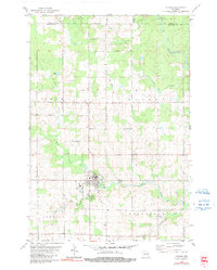
Editions of this 1980 Athens Map
2 editions found
Other maps of this area

1902 · Marathon
USGS Topo · 1:125,000

1951 · Athens
USGS Topo · 1:48,000

1951 · Hamburg
USGS Topo · 1:48,000

1953 · Marathon
USGS Topo · 1:48,000

1953 · Stratford
USGS Topo · 1:48,000

1953 · Eau Claire
USGS Topo · 1:250,000

1953 · Rice Lake
USGS Topo · 1:250,000

1954 · Iron Mountain
USGS Topo · 1:250,000

1955 · Green Bay
USGS Topo · 1:250,000

1958 · Eau Claire
USGS Topo · 1:250,000