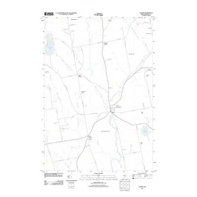
2011 Map of Athens
USGS Topo · Published 2011About this map
The Wesserunsett Stream and its numerous branches dominate this Somerset County landscape, converging near the central settlement of Athens. This 2011 survey reveals a rural network defined by its hydrology and high ground, where the West Branch Wesserunsett Stream and East Branch Wesserunsett Stream carve through a terrain of prominent hills and ridges. Genealogists will find significant value in the mapped burial grounds, including Mount Rest Cemetery, Athens Cemetery, and several family-named sites such as Dore Hill Cemetery and Lords Hill Cemetery.
Find a feature on this map
77 named features on this map. Tap any name to fly to it.
Don’t see what you’re looking for? This feature index may not catch every label — zoom into the map to look around manually.
Map Details
Editions of this 2011 Athens Map
This is the sole edition of this map. No revisions or reprints were ever made.
Other maps of this area

1903 · Bingham
USGS Topo · 1:62,500

1904 · Anson
USGS Topo · 1:62,500

1905 · Bingham
USGS Topo · 1:62,500

1913 · Skowhegan
USGS Topo · 1:62,500

1948 · Bangor
USGS Topo · 1:250,000

1948 · Kingsbury
USGS Topo · 1:62,500

1950 · Kingsbury
USGS Topo · 1:62,500

1954 · Millinocket
USGS Topo · 1:250,000

1955 · Anson
USGS Topo · 1:62,500

1955 · Skowhegan
USGS Topo · 1:62,500