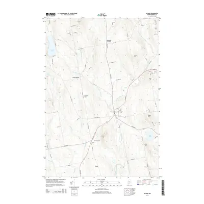
2014 Map of Athens
USGS Topo · Published 2014About this map
Athens serves as the central hub of this Somerset County landscape, where the confluence of Wesserunsett Stream and several smaller tributaries defines the local topography. The map illustrates a rural settlement pattern anchored by small crossroads such as Corsons Corner, West Athens, and Cass Corner. These clusters, along with family-named landmarks like Chapman Ridge and Lords Hill, reflect a long history of upland farming and timber work. For genealogists, the map is particularly valuable for its precise location of several burial grounds, including Kinsman Cem and Mt Rest Cem.
Find a feature on this map
84 named features on this map. Tap any name to fly to it.
Don’t see what you’re looking for? This feature index may not catch every label — zoom into the map to look around manually.
Map Details
Editions of this 2014 Athens Map
This is the sole edition of this map. No revisions or reprints were ever made.
Other maps of this area

1903 · Bingham
USGS Topo · 1:62,500

1904 · Anson
USGS Topo · 1:62,500

1905 · Bingham
USGS Topo · 1:62,500

1913 · Skowhegan
USGS Topo · 1:62,500

1948 · Bangor
USGS Topo · 1:250,000

1948 · Kingsbury
USGS Topo · 1:62,500

1950 · Kingsbury
USGS Topo · 1:62,500

1954 · Millinocket
USGS Topo · 1:250,000

1955 · Anson
USGS Topo · 1:62,500

1955 · Skowhegan
USGS Topo · 1:62,500