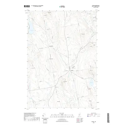
2018 Map of Athens
USGS Topo · Published 2018About this map
Wesserunsett Stream and its eastern and western branches define the drainage of this Somerset County landscape, where the village of Athens serves as a central hub. The area is characterized by significant topographic rises including Chapman Ridge, Stickney Hill, and Porcupine Mtn. Local family history is well-preserved through numerous burial grounds such as Mount Rest Cem, Kinsman Cem, and Lords Hill Cem, many of which are situated near established homesteading ridges like West Ridge and East Ridge. Water features are prominent throughout the quadrangle, ranging from the larger Ironbound Pond in the northwest to Barker Pond in the southeast, connected by a network of named brooks like Haley Brook and Longley Brook. The settlement pattern follows these watercourses and ridgelines, with West Athens appearing as a distinct secondary cluster of development along the western branch of the stream.
Find a feature on this map
69 named features on this map. Tap any name to fly to it.
Don’t see what you’re looking for? This feature index may not catch every label — zoom into the map to look around manually.
Map Details
Editions of this 2018 Athens Map
This is the sole edition of this map. No revisions or reprints were ever made.
Other maps of this area

1903 · Bingham
USGS Topo · 1:62,500

1904 · Anson
USGS Topo · 1:62,500

1905 · Bingham
USGS Topo · 1:62,500

1913 · Skowhegan
USGS Topo · 1:62,500

1948 · Bangor
USGS Topo · 1:250,000

1948 · Kingsbury
USGS Topo · 1:62,500

1950 · Kingsbury
USGS Topo · 1:62,500

1954 · Millinocket
USGS Topo · 1:250,000

1955 · Anson
USGS Topo · 1:62,500

1955 · Skowhegan
USGS Topo · 1:62,500