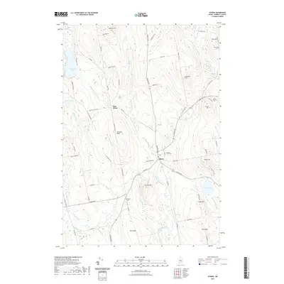
2021 Map of Athens
USGS Topo · Published 2021About this map
Athens serves as the central hub of this Somerset County landscape, situated at the confluence of the W Br Wesserunsett Stream and the E Br Wesserunsett Stream. The village is anchored by Mount Rest Cem and several arterial roads like Harmony Rd and Brighton Rd that radiate into the surrounding highlands. To the west, the smaller settlement of West Athens sits nestled between Chapman Ridge and the Bog Brook valley. This topography is defined by its numerous family-named peaks and ridges, including Dore Hill, Lords Hill, and Parlin Hill, suggesting a history of upland farming and woodlot management. The hydrography is equally prominent, ranging from the large Ironbound Pond in the northwest to the secluded Barker Pond in the southeast, with Ruins Brook hinting at earlier industrial or agricultural activity along the water's edge.
Find a feature on this map
75 named features on this map. Tap any name to fly to it.
Don’t see what you’re looking for? This feature index may not catch every label — zoom into the map to look around manually.
Map Details
Editions of this 2021 Athens Map
This is the sole edition of this map. No revisions or reprints were ever made.
Other maps of this area

1903 · Bingham
USGS Topo · 1:62,500

1904 · Anson
USGS Topo · 1:62,500

1905 · Bingham
USGS Topo · 1:62,500

1913 · Skowhegan
USGS Topo · 1:62,500

1948 · Bangor
USGS Topo · 1:250,000

1948 · Kingsbury
USGS Topo · 1:62,500

1950 · Kingsbury
USGS Topo · 1:62,500

1954 · Millinocket
USGS Topo · 1:250,000

1955 · Anson
USGS Topo · 1:62,500

1955 · Skowhegan
USGS Topo · 1:62,500