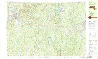
1988 Map of Athol
USGS Topo · Published 1988About this map
The Millers River and Otter River carve through a landscape defined by industrial settlements and expansive state-protected woodlands in north-central Massachusetts. The western edge is anchored by the dense street grid of Athol, where the Boston and Maine railroad tracks follow the river's path, passing by Silver Lake and Lake Ellis. This late-1980s data reveals a region structured around textile and manufacturing history, with villages like Baldwinville, Templeton, and East Templeton clustered near water-driven power sources and rail lines.
Find a feature on this map
125 named features on this map. Tap any name to fly to it.
Don’t see what you’re looking for? This feature index may not catch every label — zoom into the map to look around manually.
Map Details
Editions of this 1988 Athol Map
2 editions found
Other maps of this area

1885 · Worcester
USGS Topo · 1:62,500

1886 · Worcester
USGS Topo · 1:62,500

1887 · Warwick
USGS Topo · 1:62,500

1887 · Belchertown
USGS Topo · 1:62,500

1887 · Winchendon
USGS Topo · 1:62,500

1887 · Barre
USGS Topo · 1:62,500

1887 · Fitchburg
USGS Topo · 1:62,500

1889 · Fitchburg
USGS Topo · 1:62,500

1889 · Barre
USGS Topo · 1:62,500

1889 · Warwick
USGS Topo · 1:62,500