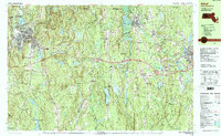
1988 Map of Athol
USGS Topo · Published 1988About this map
The Millers River corridor and its industrial landscape anchor this 1980s snapshot of north-central Massachusetts. Highlighting the intersection of historic settlement patterns and modern transit, the map illustrates the transition from the dense urban grid of Athol and the rail-oriented villages of Baldwinville and Otter River to the preserved woodland tracts of the Otter River State Forest and Harvard Forest. The Boston and Maine railroad line remains a primary landmark of the valley, tracing the river's edge past the Protestant Youth Center and the Notre Dame Cem.
Find a feature on this map
102 named features on this map. Tap any name to fly to it.
Don’t see what you’re looking for? This feature index may not catch every label — zoom into the map to look around manually.
Map Details
Editions of this 1988 Athol Map
2 editions found
Other maps of this area

1885 · Worcester
USGS Topo · 1:62,500

1886 · Worcester
USGS Topo · 1:62,500

1887 · Warwick
USGS Topo · 1:62,500

1887 · Belchertown
USGS Topo · 1:62,500

1887 · Winchendon
USGS Topo · 1:62,500

1887 · Barre
USGS Topo · 1:62,500

1887 · Fitchburg
USGS Topo · 1:62,500

1889 · Fitchburg
USGS Topo · 1:62,500

1889 · Barre
USGS Topo · 1:62,500

1889 · Warwick
USGS Topo · 1:62,500