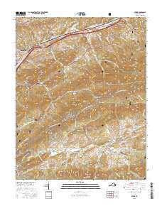
2016 Map of Atkins
USGS Topo · Published 2016About this map
Sugar Grove and the surrounding mountain ridges define this landscape where the Middle Fork Holston River and S Fork Holston River carve through the terrain. The map documents a dense network of family-named cemeteries such as Wassum Cem, Atkins Cem, and Cress Cem, highlighting the deep genealogical roots in this portion of Smyth County. The Appalachian National Scenic Trail winds over high ground near Brushy Mtn and Sheep Ridge, crossing paths with historic thoroughfares like Lead Mine Rd and Sand Mines Rd. Local industry and transit history are visible through sites like Roberts Mill and the William Andrew Scott Memorial Bridge, while the Tennessee Valley Divide marks a significant hydrological boundary between Rye Valley and the northern slopes.
Find a feature on this map
89 named features on this map. Tap any name to fly to it.
Don’t see what you’re looking for? This feature index may not catch every label — zoom into the map to look around manually.
Map Details
Editions of this 2016 Atkins Map
This is the sole edition of this map. No revisions or reprints were ever made.
Other maps of this area

1889 · Wytheville
USGS Topo · 1:125,000

1891 · Abingdon
USGS Topo · 1:125,000

1892 · Wytheville
USGS Topo · 1:125,000

1894 · Abingdon
USGS Topo · 1:125,000

1909 · Abingdon
USGS Topo · 1:96,000

1911 · Abingdon
USGS Topo · 1:125,000

1931 · Rural Retreat
USGS Topo · 1:48,000
1934 · Chatham Hill
USGS Topo · 1:24,000

1935 · Nebo
USGS Topo · 1:24,000

1935 · Mouth of Wilson
USGS Topo · 1:48,000