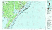
1984 Map of Atlantic City
USGS Topo · Published 1985About this map
The Jersey Shore and its inland Pine Barrens ecosystem are documented here in the mid-1980s, showcasing a landscape defined by barrier islands and extensive conservation lands. From the dense street grids of Atlantic City and Ocean City to the inland reaches of Mays Landing, the map tracks the critical transportation corridors of the Garden State Parkway and the Atlantic City Expressway. The southern coast is a complex network of inlets and sounds, including Absecon Inlet and Townsend Sound, protecting the mainland from the Atlantic Ocean.
Find a feature on this map
89 named features on this map. Tap any name to fly to it.
Don’t see what you’re looking for? This feature index may not catch every label — zoom into the map to look around manually.
Map Details
Editions of this 1984 Atlantic City Map
This is the sole edition of this map. No revisions or reprints were ever made.
Other maps of this area

1884 · Sea Isle
USGS Topo · 1:62,500

1887 · Atlantic City
USGS Topo · 1:62,500

1888 · Cape May
USGS Topo · 1:62,500

1888 · Dennisville
USGS Topo · 1:62,500

1888 · Little Egg Harbor
USGS Topo · 1:62,500

1888 · Sea Isle
USGS Topo · 1:62,500

1888 · Long Beach
USGS Topo · 1:62,500

1890 · Great Egg Harbor
USGS Topo · 1:62,500

1890 · Hammonton
USGS Topo · 1:62,500

1890 · Tuckahoe
USGS Topo · 1:62,500