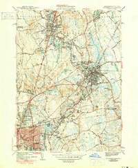
1943 Map of Attleboro
USGS Topo · Published 1950About this map
Industrial and residential centers define this mid-century landscape where the Ten Mile River and Bungay River converge. Attleboro and North Attleboro serve as the primary hubs, linked by the New York New Haven And Hartford railroad and the burgeoning traffic along Newport Ave. The map reveals a dense network of local institutions, from the prominent La Sallette Seminary to numerous community anchors like St Johns Cem and the Washington Sch.
Find a feature on this map
104 named features on this map. Tap any name to fly to it.
Don’t see what you’re looking for? This feature index may not catch every label — zoom into the map to look around manually.
Map Details
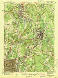
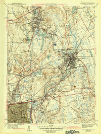
Editions of this 1943 Attleboro Map
3 editions found
Other maps of this area

1885 · Taunton
USGS Topo · 1:62,500

1886 · Dedham
USGS Topo · 1:62,500

1887 · Franklin
USGS Topo · 1:62,500

1887 · Providence
USGS Topo · 1:62,500

1888 · Taunton
USGS Topo · 1:62,500

1889 · Providence
USGS Topo · 1:62,500

1889 · Franklin
USGS Topo · 1:62,500

1893 · Taunton
USGS Topo · 1:62,500

1893 · Franklin
USGS Topo · 1:62,500

1894 · Dedham
USGS Topo · 1:62,500