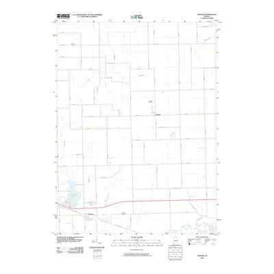
2010 Map of Atwood
USGS Topo · Published 2010About this map
Atwood and Clunette anchor this portion of Kosciusko County, showcasing a landscape defined by its intricate water management system and agricultural grid. The southern border is traced by the Tippecanoe River, while the rest of the terrain is a network of named drainage features like Truax Ditch, Fleugel Ditch, and Pole Run Ditch. These man-made and natural watercourses, including several “arms” such as Hatfield Arm and Wolf Arm, highlight the intensive land use required to maintain the productivity of this glaciated Indiana plain.
Find a feature on this map
53 named features on this map. Tap any name to fly to it.
Don’t see what you’re looking for? This feature index may not catch every label — zoom into the map to look around manually.
Map Details
Editions of this 2010 Atwood Map
This is the sole edition of this map. No revisions or reprints were ever made.
Other maps of this area

1950 · Leesburg
USGS Topo · 1:24,000

1951 · Milford
USGS Topo · 1:24,000

1953 · Fort Wayne
USGS Topo · 1:250,000

1953 · Chicago
USGS Topo · 1:250,000

1956 · Fort Wayne
USGS Topo · 1:250,000

1957 · Chicago
USGS Topo · 1:250,000

1957 · Warsaw
USGS Topo · 1:24,000

1958 · Nappanee West
USGS Topo · 1:24,000

1958 · Nappanee East
USGS Topo · 1:24,000

1958 · Bourbon
USGS Topo · 1:24,000