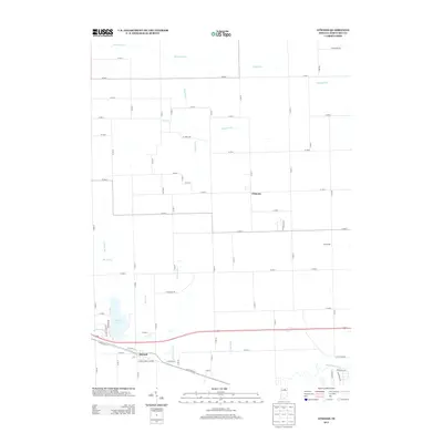
2013 Map of Atwood
USGS Topo · Published 2013About this map
Atwood anchors the southern portion of this landscape, situated along the corridor of W Old Road 30. The surrounding terrain in Kosciusko County is defined by an intricate network of agricultural drainage systems, including Dausman Ditch, Pole Run Ditch, and Truax Ditch, which support the productive farmlands between Clunette and the Tippecanoe River. To the west, Hoffman Lake remains a prominent local landmark, fed and drained by various tributaries such as Robinson Ditch and Wolf Arm. The map reveals a highly structured grid of section roads, including W Wallace Rd and W Summy Rd, which connect these small settlements and outlying farmsteads. This early 21st-century survey highlights the enduring rural character of the region, where water management through ditches like Fleugel Ditch and Miller Arm is essential to the local geography.
Find a feature on this map
66 named features on this map. Tap any name to fly to it.
Don’t see what you’re looking for? This feature index may not catch every label — zoom into the map to look around manually.
Map Details
Editions of this 2013 Atwood Map
This is the sole edition of this map. No revisions or reprints were ever made.
Other maps of this area

1950 · Leesburg
USGS Topo · 1:24,000

1951 · Milford
USGS Topo · 1:24,000

1953 · Fort Wayne
USGS Topo · 1:250,000

1953 · Chicago
USGS Topo · 1:250,000

1956 · Fort Wayne
USGS Topo · 1:250,000

1957 · Chicago
USGS Topo · 1:250,000

1957 · Warsaw
USGS Topo · 1:24,000

1958 · Nappanee West
USGS Topo · 1:24,000

1958 · Nappanee East
USGS Topo · 1:24,000

1958 · Bourbon
USGS Topo · 1:24,000