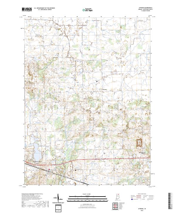
2022 Map of Atwood
USGS Topo · Published 2022About this map
Atwood and the village of Clunette anchor this portion of Kosciusko County, where the landscape is defined by a dense network of agricultural drainage systems and small glacial basins. The area around Hoffman Lake shows a typical northern Indiana pattern of localized recreation near established farming settlements. This survey captures the intricate water management of the region through numerous named waterways such as Dausman Ditch, Fleugel Ditch, and Hatfield Arm, which feed toward the Tippecanoe River in the southeast corner. Genealogists will find several burial sites recorded, including Highland Cem, Clunette Cem, and Graber Cem. The eastern edge of the sheet includes the western outskirts of Warsaw, showing the intersection of rural township lines and emerging municipal growth near the Old Channel Kankakee River.
Find a feature on this map
77 named features on this map. Tap any name to fly to it.
Don’t see what you’re looking for? This feature index may not catch every label — zoom into the map to look around manually.
Map Details
Editions of this 2022 Atwood Map
This is the sole edition of this map. No revisions or reprints were ever made.
Other maps of this area

1950 · Leesburg
USGS Topo · 1:24,000

1951 · Milford
USGS Topo · 1:24,000

1953 · Fort Wayne
USGS Topo · 1:250,000

1953 · Chicago
USGS Topo · 1:250,000

1956 · Fort Wayne
USGS Topo · 1:250,000

1957 · Chicago
USGS Topo · 1:250,000

1957 · Warsaw
USGS Topo · 1:24,000

1958 · Nappanee West
USGS Topo · 1:24,000

1958 · Nappanee East
USGS Topo · 1:24,000

1958 · Bourbon
USGS Topo · 1:24,000