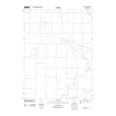
2010 Map of Atwood NE
USGS Topo · Published 2010About this map
The North Sterling Canal snakes through this high plains landscape of northeastern Colorado, illustrating the vital role of irrigation infrastructure in the region's agricultural development. This survey reveals a grid-patterned network of rural roads that define the terrain north of the South Platte River corridor. Significant water features like Springdale Creek and Sand Creek cut across these county lines, while the Pawnee Ditch further emphasizes the managed nature of the local hydrology. Near the southern edge of the map, the small residential footprints of Deerfield St and Bluestem St suggest localized community nodes within the broader expanse of Logan County. The presence of Springdale Spring serves as a reminder of the natural water sources that originally drew settlers to these plains before the extensive canal systems were engineered.
Find a feature on this map
25 named features on this map. Tap any name to fly to it.
Don’t see what you’re looking for? This feature index may not catch every label — zoom into the map to look around manually.
Map Details
Editions of this 2010 Atwood NE Map
This is the sole edition of this map. No revisions or reprints were ever made.
Other maps of this area

1951 · Willard
USGS Topo · 1:24,000

1951 · Sterling South
USGS Topo · 1:24,000

1951 · Sterling North
USGS Topo · 1:24,000

1951 · Wild Horse Lake
USGS Topo · 1:24,000

1951 · Atwood NE
USGS Topo · 1:24,000

1951 · Atwood
USGS Topo · 1:24,000

1952 · Padroni
USGS Topo · 1:24,000

1954 · Sterling
USGS Topo · 1:250,000

1958 · Sterling
USGS Topo · 1:250,000
1978 · North Sterling Reservoir
USGS Topo · 1:24,000