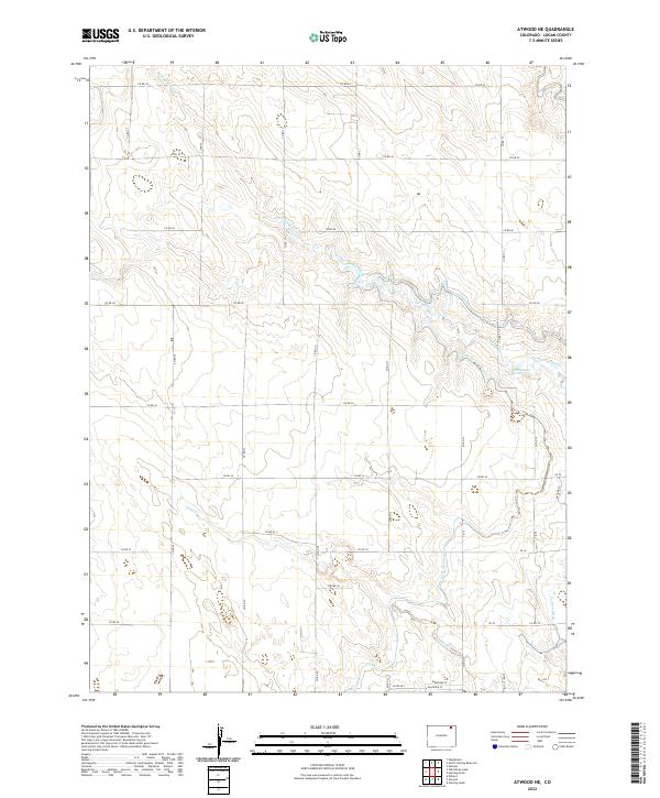
2022 Map of Atwood NE
USGS Topo · Published 2022About this map
The high plains of Logan County are defined by a complex network of water management features and section-line roads. The North Sterling Canal winds through the eastern half of the map, a critical piece of agricultural infrastructure that supports the semi-arid landscape. Natural drainages like Springdale Cr and Sand Cr cut across the terrain, leading toward the Springdale Spring. This modern survey reveals how early township and range boundaries, marked here as t9n r54w and t9n r53w, continue to dictate the layout of rural travel and land use. The presence of the Pawnee Ditch in the southeast corner further emphasizes the reliance on diverted water for this region's development. Local transit is largely confined to a grid of county roads, including Co RD 44 and Co RD 33, which serve the scattered residential developments near Shelbe Ln and Deerfield St.
Find a feature on this map
36 named features on this map. Tap any name to fly to it.
Don’t see what you’re looking for? This feature index may not catch every label — zoom into the map to look around manually.
Map Details
Editions of this 2022 Atwood NE Map
This is the sole edition of this map. No revisions or reprints were ever made.
Other maps of this area

1951 · Willard
USGS Topo · 1:24,000

1951 · Sterling South
USGS Topo · 1:24,000

1951 · Sterling North
USGS Topo · 1:24,000

1951 · Wild Horse Lake
USGS Topo · 1:24,000

1951 · Atwood NE
USGS Topo · 1:24,000

1951 · Atwood
USGS Topo · 1:24,000

1952 · Padroni
USGS Topo · 1:24,000

1954 · Sterling
USGS Topo · 1:250,000

1958 · Sterling
USGS Topo · 1:250,000
1978 · North Sterling Reservoir
USGS Topo · 1:24,000