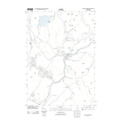
2013 Map of Au Sable Forks
USGS Topo · Published 2013About this map
Au Sable Forks sits at the convergence of the West Br Ausable River and the E Br Ausable River, serving as a central hub in this corner of the Adirondack Park Preserve. The landscape is defined by the sharp descent of water from high peaks like Fern Lake Mtn and Haystack Mtn toward the river valleys. To the north, Fern Lake is a prominent water body near the settlement of Stevens Landing, while to the west, the village of Black Brook is tucked along its namesake pond. Historical infrastructure remains visible through the network of spans, including the Grove Road Bridge and Stickney Bridge, which facilitate travel between the scattered upland farms such as Asgaard Farm and the more concentrated residential streets of Green Street and the southern village of Jay.
Find a feature on this map
128 named features on this map. Tap any name to fly to it.
Don’t see what you’re looking for? This feature index may not catch every label — zoom into the map to look around manually.
Map Details
Editions of this 2013 Au Sable Forks Map
This is the sole edition of this map. No revisions or reprints were ever made.
Other maps of this area

1895 · Ausable
USGS Topo · 1:62,500

1896 · Lake Placid
USGS Topo · 1:62,500

1898 · Lake Placid
USGS Topo · 1:62,500

1903 · Ausable
USGS Topo · 1:62,500

1911 · Lyon Mountain
USGS Topo · 1:62,500

1913 · Dannemora
USGS Topo · 1:62,500

1913 · Lyon Mountain
USGS Topo · 1:62,500

1931 · Lyon Mountain
USGS Topo · 1:62,500

1950 · Lake Champlain
USGS Topo · 1:250,000

1953 · Lake Placid
USGS Topo · 1:62,500