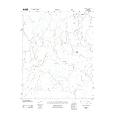
2012 Map of Auberry
USGS Topo · Published 2012About this map
Auberry and its surrounding Sierra foothills are mapped here during a period of established mountain settlement and ecological preservation. The landscape is defined by the steep descent toward the San Joaquin River, which forms the distinctive Horseshoe Bend in the northwest. In the south, the community of Tollhouse sits near the Tollhouse Cem, marking an area with deep roots in local transport history.
Find a feature on this map
90 named features on this map. Tap any name to fly to it.
Don’t see what you’re looking for? This feature index may not catch every label — zoom into the map to look around manually.
Map Details
Editions of this 2012 Auberry Map
This is the sole edition of this map. No revisions or reprints were ever made.
Other maps of this area

1904 · Kaiser
USGS Topo · 1:125,000

1912 · Mariposa
USGS Topo · 1:125,000

1922 · Trimmer
USGS Topo · 1:96,000

1923 · Academy
USGS Topo · 1:31,680

1924 · Dinuba
USGS Topo · 1:125,000

1942 · Watts Valley
USGS Topo · 1:62,500

1942 · Millerton Lake
USGS Topo · 1:62,500

1944 · Watts Valley
USGS Topo · 1:62,500

1945 · Millerton Lake
USGS Topo · 1:62,500
1946 · Clovis
USGS Topo · 1:62,500