
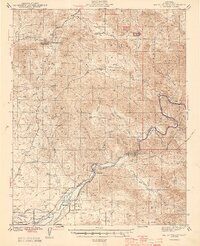
1944 Map of Watts Valley
USGS Topo · Published 1944About this map
The Kings River flows through the heart of this Fresno County landscape, carving a path between Pine Ridge and Coyote Ridge just as the region’s agricultural and mining identities were firmly established. Along the river banks, the settlement of Piedra and the Delpiedra P O anchor a corridor of activity that includes the CCC Camp near Trimmer. The foothills are dotted with small rural schoolhouses like Oakhurst Sch and Hawkins Sch, serving family-run holdings in Burrough Valley and Clark Valley.
Find a feature on this map
57 named features on this map. Tap any name to fly to it.
Don’t see what you’re looking for? This feature index may not catch every label — zoom into the map to look around manually.
Map Details
Editions of this 1944 Watts Valley Map
2 editions found
Other maps of this area

1904 · Kaiser
USGS Topo · 1:125,000

1912 · Mariposa
USGS Topo · 1:125,000

1920 · Orangedale School
USGS Topo · 1:24,000

1921 · Squaw Valley
USGS Topo · 1:31,680

1922 · Round Mountain
USGS Topo · 1:31,680

1922 · Trimmer
USGS Topo · 1:96,000

1923 · Academy
USGS Topo · 1:31,680

1923 · Orangedale School
USGS Topo · 1:31,680

1923 · Wahtoke
USGS Topo · 1:31,680

1923 · Sanger
USGS Topo · 1:31,680