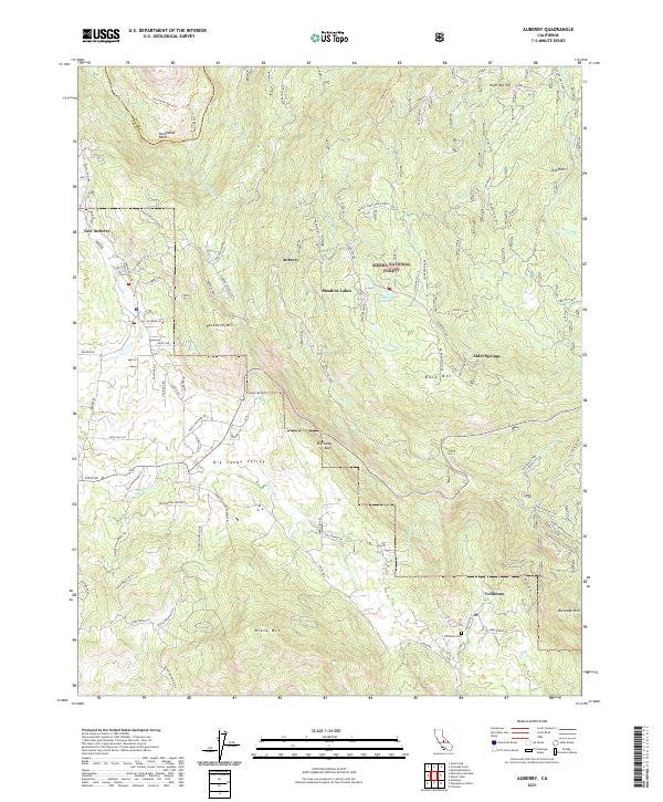
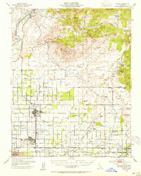
2021 Map of Auberry
USGS Topo · Published 2021About this map
Auberry and New Auberry serve as focal points in this Sierra Nevada foothills landscape, where the transition from the Big Sandy Valley to the higher elevations of the Sierra National Forest is clearly defined. The terrain is marked by significant rises like Backbone Mtn and Burrough Mtn, with the northern boundary traced by the winding San Joaquin River at Horseshoe Bend.
Find a feature on this map
93 named features on this map. Tap any name to fly to it.
Don’t see what you’re looking for? This feature index may not catch every label — zoom into the map to look around manually.
Map Details
Editions of this 2021 Auberry Map
This is the sole edition of this map. No revisions or reprints were ever made.
Other maps of this area

1904 · Kaiser
USGS Topo · 1:125,000

1912 · Mariposa
USGS Topo · 1:125,000

1922 · Trimmer
USGS Topo · 1:96,000
1923 · Academy
USGS Topo · 1:31,680

1924 · Dinuba
USGS Topo · 1:125,000
1942 · Watts Valley
USGS Topo · 1:62,500

1942 · Millerton Lake
USGS Topo · 1:62,500
1944 · Watts Valley
USGS Topo · 1:62,500
1945 · Millerton Lake
USGS Topo · 1:62,500
1946 · Clovis
USGS Topo · 1:62,500