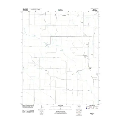
2011 Map of Aubrey
USGS Topo · Published 2011About this map
Aubrey serves as the central hub in this Lee County landscape, where the agricultural grid of the Arkansas Delta is defined by an intricate network of waterways and local roads. The terrain is shaped by the meandering paths of Big Creek and Little Hog Tusk Creek, which feed into several prominent bodies of water including McCloud Lake, McNulty Lake, and Little Mossy Lake. The map reveals a high density of small rural communities and named crossroads such as Thomasville, New Hope, and the uniquely named Turkey Scratch in the southern reaches.
Find a feature on this map
60 named features on this map. Tap any name to fly to it.
Don’t see what you’re looking for? This feature index may not catch every label — zoom into the map to look around manually.
Map Details
Editions of this 2011 Aubrey Map
This is the sole edition of this map. No revisions or reprints were ever made.
Other maps of this area

1940 · Marvell
USGS Topo · 1:62,500

1940 · Holly Grove
USGS Topo · 1:62,500

1940 · Brinkley
USGS Topo · 1:62,500

1940 · Marianna
USGS Topo · 1:62,500

1948 · Helena
USGS Topo · 1:250,000

1950 · Helena
USGS Topo · 1:250,000

1955 · Helena
USGS Topo · 1:250,000

1956 · Marvell
USGS Topo · 1:62,500
1957 · Marianna
USGS Topo · 1:62,500

1957 · Holly Grove
USGS Topo · 1:62,500