1957 Map of Holly Grove
USGS Topo · Published 1957About this map
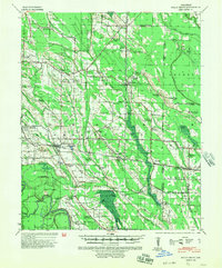
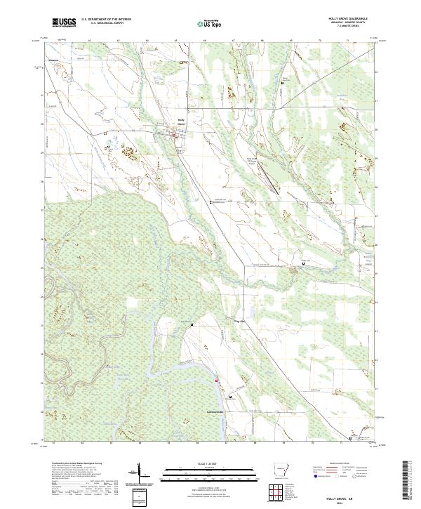
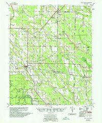
The town of Holly Grove serves as the central hub of this East Arkansas delta survey, where the Missouri Pacific railroad intersects a landscape defined by an intricate network of sloughs and bayous. The map documents a rural society deeply connected to its land and community institutions, evidenced by the high density of combination landmarks such as Pine Ridge Ch Cem & Sch and Shiloh Ch & Cem. The terrain transitions from the low-lying Warrior Bottom in the east to the wetland-rich south, where Eagle Lake and Maddox Lake are surrounded by descriptive water features like Boat Gunwale Slash and Persimmon Slash. This 1957 edition, prepared by the Corps of Engineers, provides a detailed look at the transition between Monroe and Phillips counties during a period when small settlements like Pine City, Blackton, and Lawrenceville remained vital local centers.
Find a feature on this map
93 named features on this map. Tap any name to fly to it.
Don’t see what you’re looking for? This feature index may not catch every label — zoom into the map to look around manually.
Map Details
Editions of this 1957 Holly Grove Map
This is the sole edition of this map. No revisions or reprints were ever made.
Historical Maps of Holly Grove Through Time
9 maps found