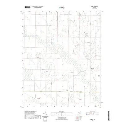
2020 Map of Aubrey
USGS Topo · Published 2020About this map
Aubrey serves as the central hub of this agricultural landscape in eastern Arkansas, where the town layout is defined by streets like Broadway and Church. The surrounding Lee County countryside is dotted with small rural communities and family-named landmarks such as Big Creek Corner and the evocatively named Turkey Scratch on the southern border. The terrain is marked by an extensive drainage system of creeks and lakes, including McCloud Lake, McNulty Lake, and the winding Big Creek. Genealogists will find a wealth of local burial sites scattered throughout the townships, from New Hope Cem and Holland Cem in the north to Saint Marks Cem and Spring Creek Cem further south. This survey captures a moment when the regional economy remained deeply tied to the land and the grid of county roads that connects these quiet settlements.
Find a feature on this map
70 named features on this map. Tap any name to fly to it.
Don’t see what you’re looking for? This feature index may not catch every label — zoom into the map to look around manually.
Map Details
Editions of this 2020 Aubrey Map
This is the sole edition of this map. No revisions or reprints were ever made.
Other maps of this area

1940 · Marvell
USGS Topo · 1:62,500

1940 · Holly Grove
USGS Topo · 1:62,500

1940 · Brinkley
USGS Topo · 1:62,500

1940 · Marianna
USGS Topo · 1:62,500

1948 · Helena
USGS Topo · 1:250,000

1950 · Helena
USGS Topo · 1:250,000

1955 · Helena
USGS Topo · 1:250,000

1956 · Marvell
USGS Topo · 1:62,500
1957 · Marianna
USGS Topo · 1:62,500

1957 · Holly Grove
USGS Topo · 1:62,500