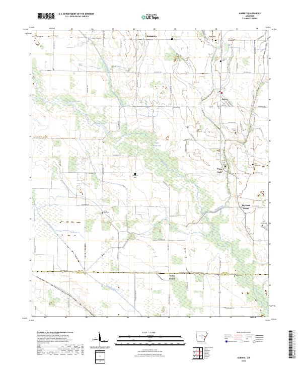
2024 Map of Aubrey
USGS Topo · Published 2024About this map
Aubrey serves as the primary settlement hub in this part of Lee County, where the landscape is defined by the complex hydrology of the Arkansas Delta. The area is characterized by an intricate network of waterways, including Big Creek, Spring Creek, and Little Mossy Creek, alongside significant bodies of water like McCloud Lake and McNulty Lake. This 2024 survey reveals a rural landscape deeply rooted in its local geography, with numerous small cemeteries such as Jones Family Cem Number 2, Holland Cem, and New Hope Cem providing essential data for genealogical research. The boundary between Lee and Phillips counties runs along the southern edge, near the distinctively named settlement of Turkey Scratch. The map illustrates a developed rural road system, including State Hwy 78, which connects these scattered communities and landmarks across the wetlands and low-lying plains.
Find a feature on this map
54 named features on this map. Tap any name to fly to it.
Don’t see what you’re looking for? This feature index may not catch every label — zoom into the map to look around manually.
Map Details
Editions of this 2024 Aubrey Map
This is the sole edition of this map. No revisions or reprints were ever made.
Other maps of this area

1940 · Marvell
USGS Topo · 1:62,500

1940 · Holly Grove
USGS Topo · 1:62,500

1940 · Brinkley
USGS Topo · 1:62,500

1940 · Marianna
USGS Topo · 1:62,500

1948 · Helena
USGS Topo · 1:250,000

1950 · Helena
USGS Topo · 1:250,000

1955 · Helena
USGS Topo · 1:250,000

1956 · Marvell
USGS Topo · 1:62,500
1957 · Marianna
USGS Topo · 1:62,500

1957 · Holly Grove
USGS Topo · 1:62,500