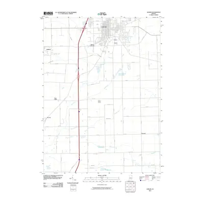
2010 Map of Auburn
USGS Topo · Published 2010About this map
Auburn serves as the central hub of this 2010 survey, showing the city's modern street grid and its connection to Auburn Junction and the eastern edge of Garrett. The landscape is defined by an intricate network of drainage ditches and natural waterways, including the winding path of Cedar Creek and the Cecil-Metcalf Ditch. These water systems, alongside family-named features like the John Diehl Ditch and Dosch Ditch, illustrate the region's managed agricultural topography. Small historic clusters and rural junctions such as Saint Johns, New Era, and Hopewell are interspersed throughout the southern half of the quadrangle. Significant local landmarks include Roselawn Cemetery and Woodlawn Cemetery on the city's outskirts, as well as the Auburn Dekalb Airport. The map documents a landscape of established transit corridors and varied water bodies, from Saint Anthonys Center Lake to the small pools of Beedy Lake and Dunton Lake.
Find a feature on this map
54 named features on this map. Tap any name to fly to it.
Don’t see what you’re looking for? This feature index may not catch every label — zoom into the map to look around manually.
Map Details
Editions of this 2010 Auburn Map
This is the sole edition of this map. No revisions or reprints were ever made.
Other maps of this area

1953 · Fort Wayne
USGS Topo · 1:250,000

1955 · Corunna
USGS Topo · 1:24,000

1956 · Fort Wayne
USGS Topo · 1:250,000

1956 · Cedarville
USGS Topo · 1:24,000

1957 · Auburn
USGS Topo · 1:24,000

1957 · Waterloo
USGS Topo · 1:24,000

1957 · Huntertown
USGS Topo · 1:24,000

1957 · Garrett
USGS Topo · 1:24,000

1958 · Grabill
USGS Topo · 1:24,000

1958 · Butler West
USGS Topo · 1:24,000