
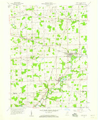
1957 Map of Auburn
USGS Topo · Published 1959About this map
Auburn functions as a vital rail hub in the late 1950s, defined by the convergence of the New York Central, Baltimore and Ohio, and Pennsylvania railroads. This network anchors the landscape, connecting the county seat to satellite settlements like Auburn Junction and Saint Johns. The map reveals a community deeply invested in its local infrastructure, featuring a dense concentration of civic institutions including the Courthouse, several schools like Riley Sch and De Soto Sch, and sprawling burial grounds such as Roselawn Cem.
Find a feature on this map
57 named features on this map. Tap any name to fly to it.
Don’t see what you’re looking for? This feature index may not catch every label — zoom into the map to look around manually.
Map Details
Editions of this 1957 Auburn Map
This is the sole edition of this map. No revisions or reprints were ever made.
Other maps of this area

1953 · Fort Wayne
USGS Topo · 1:250,000

1955 · Corunna
USGS Topo · 1:24,000

1956 · Fort Wayne
USGS Topo · 1:250,000

1956 · Cedarville
USGS Topo · 1:24,000

1957 · Waterloo
USGS Topo · 1:24,000

1957 · Huntertown
USGS Topo · 1:24,000

1957 · Garrett
USGS Topo · 1:24,000

1958 · Grabill
USGS Topo · 1:24,000

1958 · Butler West
USGS Topo · 1:24,000
1958 · Saint Joe
USGS Topo · 1:24,000