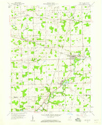
1958 Map of Saint Joe
USGS Topo · Published 1960About this map
The St Joseph River meanders through this portion of eastern DeKalb County, serving as the primary geographical anchor for the villages of Saint Joe and Spencerville. In the late 1950s, this landscape remained largely agricultural, defined by an intricate network of drainage systems like Boger Ditch and Metcalf Ditch that reclaimed the fertile land between the river and Cedar Creek. The Baltimore and Ohio railroad cuts a straight line through the territory, passing through the town of Concord and maintaining the region's connection to the larger industrial rail network.
Find a feature on this map
51 named features on this map. Tap any name to fly to it.
Don’t see what you’re looking for? This feature index may not catch every label — zoom into the map to look around manually.
Map Details
Editions of this 1958 Saint Joe Map
3 editions found
Other maps of this area

1953 · Fort Wayne
USGS Topo · 1:250,000

1956 · Fort Wayne
USGS Topo · 1:250,000

1956 · Cedarville
USGS Topo · 1:24,000

1957 · Auburn
USGS Topo · 1:24,000

1957 · Waterloo
USGS Topo · 1:24,000

1958 · Hicksville
USGS Topo · 1:24,000

1958 · Grabill
USGS Topo · 1:24,000

1958 · Butler West
USGS Topo · 1:24,000

1958 · Woodburn North
USGS Topo · 1:24,000

1958 · Butler East
USGS Topo · 1:24,000