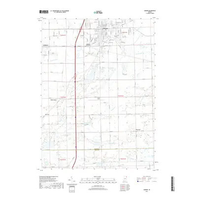
2019 Map of Auburn
USGS Topo · Published 2019About this map
Auburn and Garrett anchor this 2019 survey of DeKalb County, Indiana, where the urban street grids meet an extensive network of agricultural drainage. The city of Auburn is particularly well-documented, featuring its rail heritage at Auburn Junction and its central community sites like Woodlawn Cem and Roselawn Cem. Between the population centers, the landscape is defined by the managed flow of water through engineered systems like the John Diehl Ditch and the Schmadel Ditch, which feed into the more natural path of Cedar Creek. Further south, the rural character is punctuated by smaller hamlets and crossroads such as Saint Johns, New Era, and Hopewell. The presence of the De-Kalb County Airport and the active CSX Transportation line reflects the area's continued role as a regional transit and logistics hub within the DeKalb and Allen County borderlands.
Find a feature on this map
136 named features on this map. Tap any name to fly to it.
Don’t see what you’re looking for? This feature index may not catch every label — zoom into the map to look around manually.
Map Details
Editions of this 2019 Auburn Map
This is the sole edition of this map. No revisions or reprints were ever made.
Other maps of this area

1953 · Fort Wayne
USGS Topo · 1:250,000

1955 · Corunna
USGS Topo · 1:24,000

1956 · Fort Wayne
USGS Topo · 1:250,000

1956 · Cedarville
USGS Topo · 1:24,000

1957 · Auburn
USGS Topo · 1:24,000

1957 · Waterloo
USGS Topo · 1:24,000

1957 · Huntertown
USGS Topo · 1:24,000

1957 · Garrett
USGS Topo · 1:24,000

1958 · Grabill
USGS Topo · 1:24,000

1958 · Butler West
USGS Topo · 1:24,000