1983 Map of Auburn
USGS Topo · Published 1983About this map
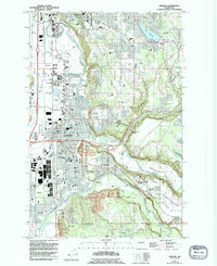
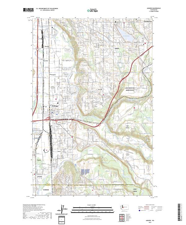
The Green River carves a deep valley through this corner of King County, defining the landscape between the growing city of Auburn and the coal-mining heritage of Black Diamond. In the early 1980s, the region shows a mix of suburban expansion and heavy industry, with numerous Gravel Pits and the extensive rail infrastructure of the Burlington Northern and Northern Pacific lines. Educational and agricultural institutions are prominent, including the Auburn Adventist Academy and the Green River State Salmon Hatchery.
Find a feature on this map
69 named features on this map. Tap any name to fly to it.
Don’t see what you’re looking for? This feature index may not catch every label — zoom into the map to look around manually.
Map Details
Editions of this 1983 Auburn Map
This is the sole edition of this map. No revisions or reprints were ever made.