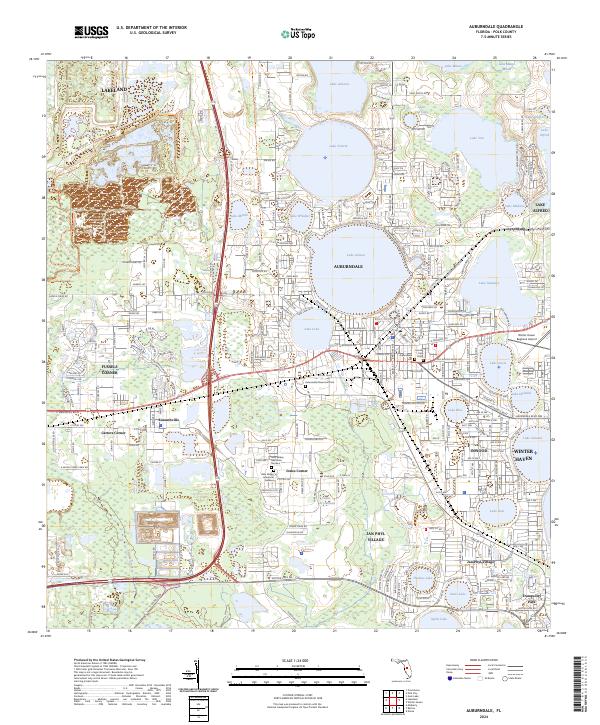
2024 Map of Auburndale
USGS Topo · Published 2024About this map
The lake-dotted landscape of central Polk County defines this contemporary survey, where the city of Auburndale sits surrounded by numerous named water bodies including Lake Ariana, Lake Lena, and Lake Stella. The map documents a complex network of established communities and crossroads such as Fussels Corner, Kossuthville, and Jones Corner, illustrating the dense suburban and agricultural integration characteristic of this region. The presence of the Winter Haven Regional Airport and extensive thoroughfares like the Dixie Hwy and E Memorial Blvd highlight the area's role as a transportation hub. Genealogists and local historians will find significant detail in the placement of the Auburndale Cem and Auburndale Memorial Park, alongside conservation areas like the Tenoroc Fish Management Area.
Find a feature on this map
104 named features on this map. Tap any name to fly to it.
Don’t see what you’re looking for? This feature index may not catch every label — zoom into the map to look around manually.
Map Details
Editions of this 2024 Auburndale Map
This is the sole edition of this map. No revisions or reprints were ever made.
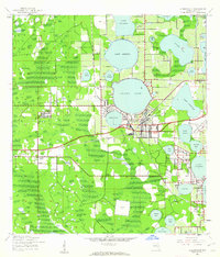
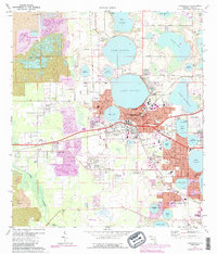
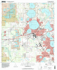
Historical Maps of Eagle Lake Through Time
4 maps found